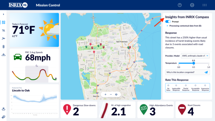
INRIX pioneered the use of GPS data from connected vehicles for transportation intelligence. In this post, we partnered with Amazon Web Services (AWS) customer INRIX to demonstrate how Amazon Bedrock can be used to determine the best countermeasures for specific city locations using rich transportation data and how such countermeasures can be automatically visualized in street view images. This approach allows for significant planning acceleration compared to traditional approaches using conceptual drawings.
How INRIX accelerates transportation planning with Amazon Bedrock