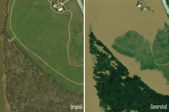
New AI tool generates realistic satellite images of future flooding November 25, 2024 By admin With help from AI, MIT scientists developed a method that generates satellite imagery from the future to depict how a region would look after a potential flooding event.